El Camino Del Diablo

By Franklin Lane
Traversing “The Devil’s Highway” from Ajo to Yuma has been on my Sonoran Desert bucket list for quite a while. It has just been a matter of the right time, the right wingman and the right vehicle. In late March 2023 I finally pulled together all three. This time of year, the weather is still agreeable, and my long-time exploring buddy (everybody needs one) was game if I bought the bacanora and did the camp cooking. Padre Kino did the Camino in 1699 on foot and horseback. We decided on a 2017 Jeep Rubicon.
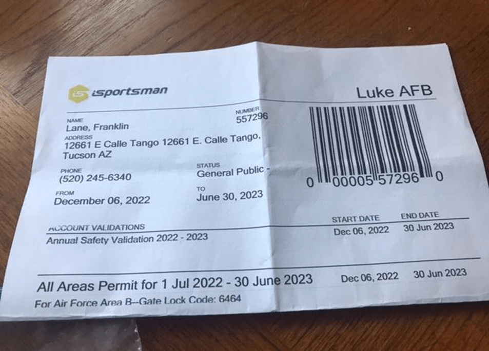
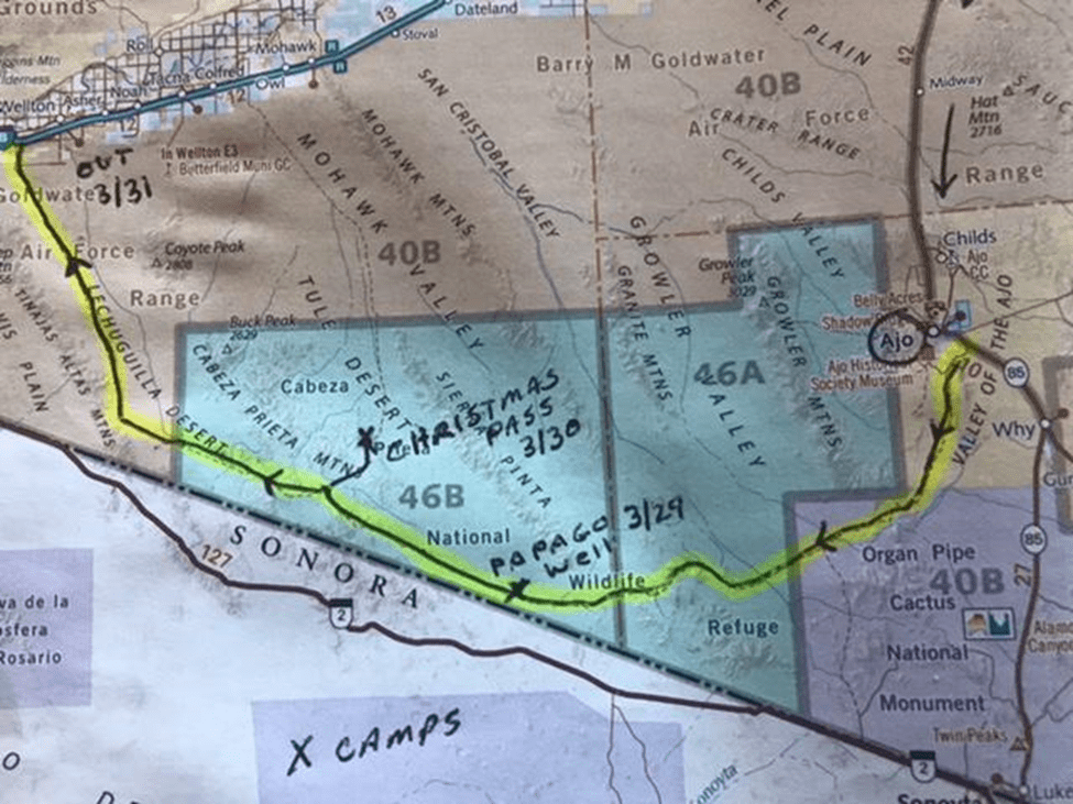
Our @ 125-mile route went through multiple jurisdictions. It began on BLM land as we turned onto Darby Well Road just south of Ajo. We cut through the Northwest corner of Organ Pipe National Monument and then entered Cabeza Prieta National Wildlife Refuge. The last part of the Camino was in the USAF/USMC Goldwater Aviation Firing Range. For this reason, you must obtain a permit from Luke Air Force Base. See sample document below. It requires a short online orientation, safety presentation and easy quiz. Basically, the message is, “don’t pick up any unexploded ordinance.” We probably wouldn’t have done that anyway, but it was a comforting reminder.
The first non-indigenous person to travel the Camino was Captain Melchior Diaz in 1540. He had been dispatched to ascertain the head waters of the Gulf of California while Coronado and his main expedition proceeded north up the San Pedro Valley. Both were looking for those elusive Seven Cities of Gold! In 1856 U.S. Army Lieutenant Nathaniel Michler reported:
“All traces of the road are sometimes erased by high winds sweeping soil before them, but death has strewn a continuous line of bleached bones and withered carcasses of horses and cattle, as monuments to mark the way.”
A lot of these bones were from immigrants and 49ers headed to California who opted to chance this southern route to avoid Apache encounters farther north. The hope was that the deep ‘Tinajas’ in the Tinajas Altas mountains were still holding collected precipitation.
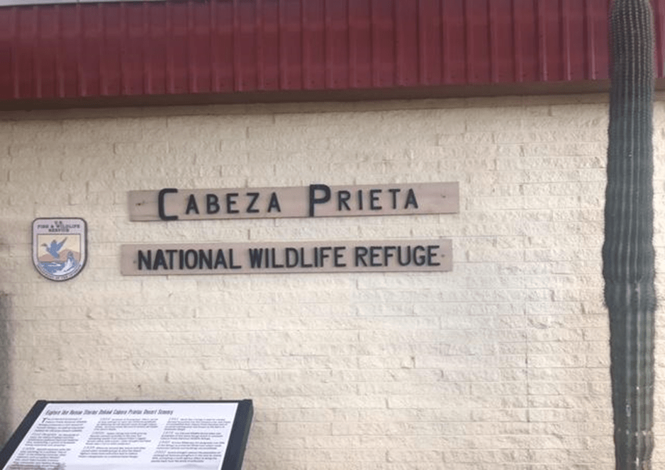
We had decided on our specific route after an earlier recon trip to the area that included receiving a briefing and set of maps at the Cabeza Prieta Wildlife Refuge field office in Ajo. We gave them a courtesy call when we started the trip. We also touched base with Master Naturalist Kim Girard (C6) who was working as a seasonal ranger at Organ Pipe.
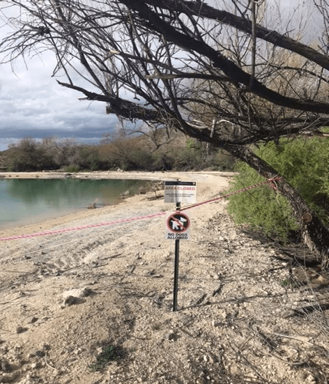
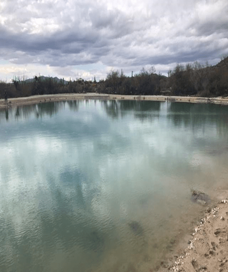
During our reconnaissance trip we also visited Quitobaquito Spring to determine for ourselves
the rumored impacts of the trump-era wall construction. While the soul-killing ‘Wall’ definitely looms near the Spring (within about 60 meters) we learned that the current low water level is actually due to a recent draining. All fauna was removed (fish, turtles etc.) and a synthetic bottom was laid to prevent future leakage. Shoreline flora will be replaced once the Spring reaches a natural balance (input – evaporation).

While this remote portion of the Sonoran Desert remains absolutely stunning, we were a bit disappointed in the lack of challenge in driving it. So much of the ‘old’ Camino we had anticipated has been graded since 2005 to provide wall construction access that it threw the timing of our transit off. We found ourselves at Christmas Pass so early in Day 2 that we decided to push on to the Tinajas Altas mountains for our second night’s camp. The map below depicts our original intent.
While a high clearance four-wheel drive vehicle is definitely needed to drive the spur road north to Christmas Pass from the intersection at Tule Well, I really feel that I could have done the rest of the trip with some cautious driving in my AWD Subaru Forester. There are some lava tongues that extend north from the Pinacate (Mexico). These rough lava beds cross the Camino between Papago Well and Tule Well but can be traversed with a bit of attention and care.
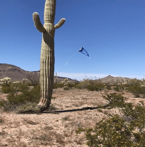
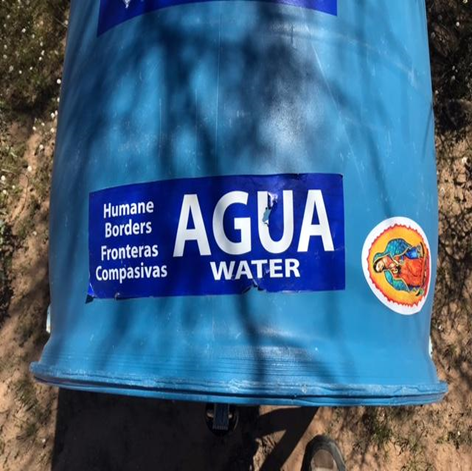
Caution however, just because the Camino has become more vehicle friendly does not mean it is now easy country. I still cannot imagine the courage and fortitude to cross this terrain on foot, especially in the summer. It is our intention to return in July or August to fully experience these challenges. Fortunately, we saw some evidence of compassion. Pictures below.
One great success of the trip was finding an elusive Ajo lily (Hesperocallis undulata). This beautiful flower is the only species in the genus. Apparently, the bulb can be eaten but has a slightly garlic taste, so the early Spaniards gave it the name Ajo (Garlic). I assume then, the namesake of the town.

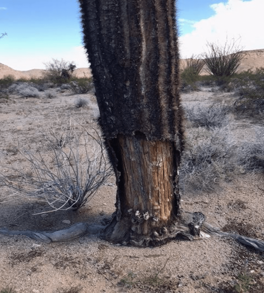
Perhaps indicative of the harshness of the environment, many of the bases of the Saguaros have been eaten away by pack rats. Other than this evidence there was a noticeable lack of fauna, particularly mammals. While we had binoculars in hopes of seeing Desert Pronghorns or some Big Horn in the Copper or Tinajas Altas Mountains…we had no success. Not even rabbits or hares. Only the sounds of birds and coyotes at night. The birds in fact made a bit of a nuisance of themselves ALL NIGHT from down in the wash at Papago Well.
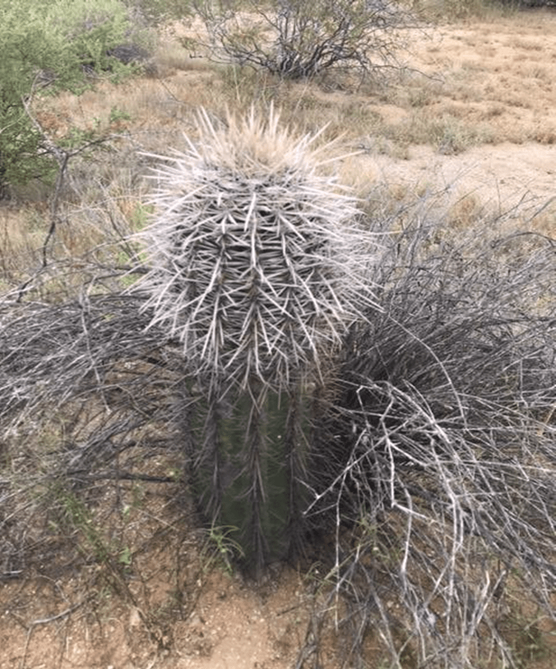
A final observation on Saguaros. While healthy Saguaros in the Tucson area often have a whitish cap, we observed that many individuals in the Cabeza Prieta were ‘whitish’ down about 1/3 of their height. I’m still researching this interesting phenomenon.
If anyone is planning a similar visit and has questions or would like additional insight, please feel free to contact me via the Pima County Chapter.
Two terrific books on the area that added to the experience include: “The Devil’s Highway” by Luis Alberto Urrea And “Sunshot” by Bill Broyles.

You must be logged in to post a comment.