PCMN Tribute to Josh Skattum
Light a candle, Scan the sky for our Red Giant, Josh Skattum.
His Super Nova life streaking across the hearts of so many is now traveling the cosmos,
Yet is undiminished.
Josh’s ethos touches us with an unending energy for doing what is good
and right as individuals and as a community of like minded souls.
Let us honor Josh by our actions consistent with his legacy of community, commitment, and Love of Nature, by giving back through volunteerism, teaching and in leadership roles.
Josh’s smile, energy, joy at finding the unexpected and for his ever expanding thirst for knowledge is a testament to his nobility as a man and his service to others.
You are forever etched upon our hearts and now shine with the Stars.
— Kathy McLin (C3)

Josh was creative, inquisitive, and a kind soul! He had an infectious laugh that I’ll always remember and made me smile! — Deb Petrich (C1)


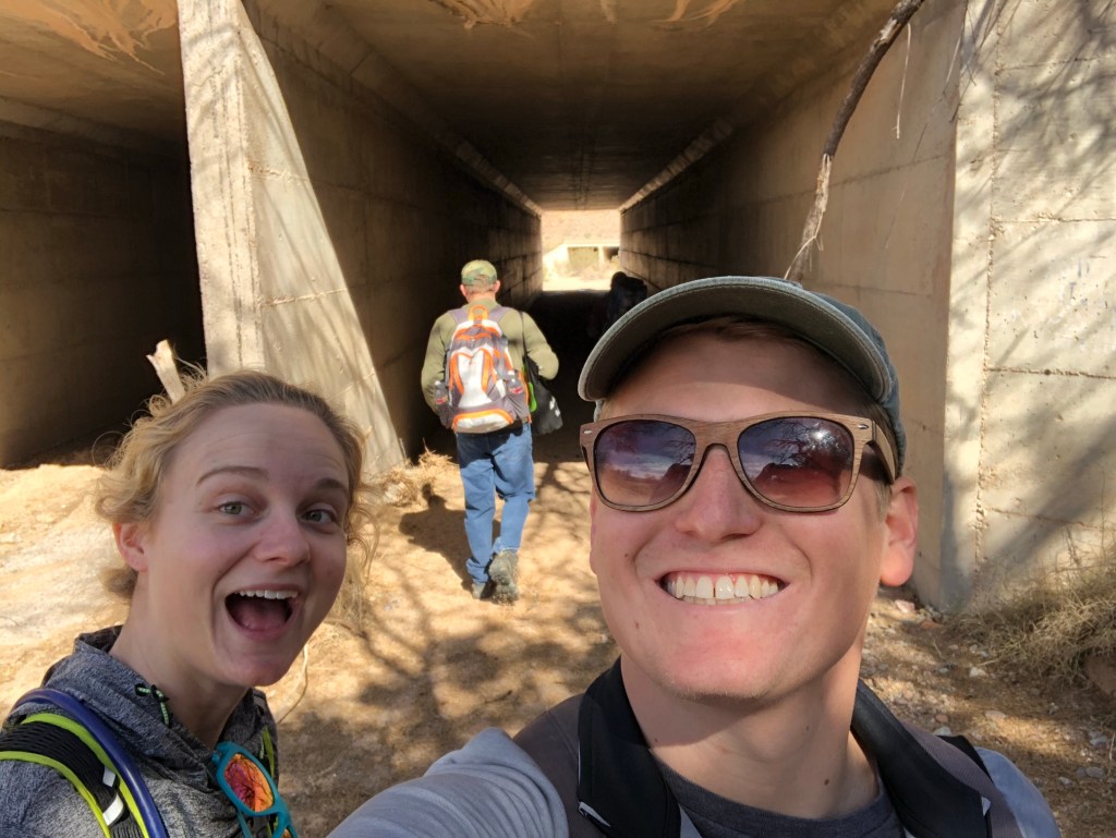
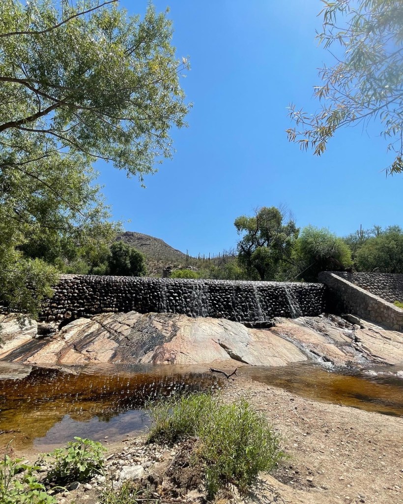
I went into the desert with Josh in December 2021. You can always tell a lot about a person in how they respond to this welcoming yet uncompromising environment. Although not from here, he seemed perfectly at home. Noticing things and asking insightful questions. Careful not to interrupt. I recall he had guests coming to town and wanted to take them out on a representative hike of the Sonoran Desert. He was excited that the route we’d chosen that day might be perfect for his friends. He was concerned that they have a good experience. Josh was not only interested in what things were but also how they worked, how they fit into the pared down honesty of the landscape. We must have stayed and examined the fallen saguaro in this picture for half an hour. Considering and discussing its fate like it was a person.
We made tentative plans to do some other hikes, make some new discoveries. But it didn’t happen and I’m sad for that. But then I’m reminded of a quote by Rumaan Alam, “You never know when a time is the last time, because if you did you could never go on with life.” — Franklin Lane (C1)
From the moment Josh showed up in our Master Naturalist Course in Cohort 3, I knew he was a special and vibrant soul. He was always there with a smile, had such exciting and fresh ideas, and was willing to help with almost anything. He jumped in, feet first, to help with our interpretation class, our communications and social committees, and helped us host our first big fundraising event. In no time he had changed our little community into something that folks wanted to join. Josh had the kind of personality that made you want to be involved and part of the team. He was ready to learn and did all he could to figure out his best path for his career, where he knew he could make a difference. Just a few weeks ago he told me how grateful he was for our community and how it helped him decide what to do next. Our world is a little less bright now but his spirit and energy will live on those he touched. I now know that my experiences with him were not unique – he shared the same passion and inspiration with everyone he knew. So long for now, friend. Looking for you to guide us on our journey. — LoriAnne Warren, Executive Director

What I loved most about Josh was his curiosity and insatiable desire to learn. A go to guy for our social media pages, Josh perked up at our annual meeting when we workshopped together using a new app that made my eyes cross. He laughed and told me he would teach me when he got it himself. We lost a kind and gentle spirit. Josh Skattum ¡PRESENTE! — Jan Schwartz (C4)
Josh was the kind of guy that showed up. His schedule was always jammed with work, volunteering, visits with friends etc but he met you as promised…with a smile that always made me feel better. I spent every Wednesday evening with him and others for five months in 2019; he was a member of our naturalists cohort. He loved every angle of this crazy world and animals had the supreme ranking in his world order. Josh was a member of the PCMN board. The last meeting I attended with him in Sept. I told him how happy he looked. He gave me that special “Josh” smile and nodded. May his loved ones cherish that knowledge as they deal with his loss. — Kathe Sudano (C3)
Like most of us, I was drawn to Josh’s light instantly. Serving on the board with him over this last year allowed me to see just why that was. That light and warmth was real, selfless, and seemingly unwavering. Josh met every request with enthusiasm and honesty, was fully present with us in every moment. This community, and keeping it nurtured, FUN, and healthy, was so important to him. I last saw him at our October Feminist Bird Club walk, and was so excited to see him pull up with TJ and a car full of friends. What a gift it was to bird with him and laugh at how 80% of Tucson is just Verdins, and how much we love Portlandia. We talked about upcoming advanced trainings, and how badly he wanted to bring connection back into our chapter with social events. He was full of ideas, had the most delightful laugh and smile, and was there to support us without hesitation. We would all do better to try and live a little more like Josh. — Melissa Fratello (C5)
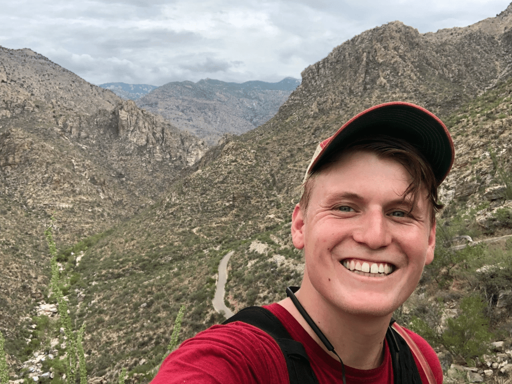
Selfie by Josh Skatum, Sweetwater Wetlands, 10/9/22
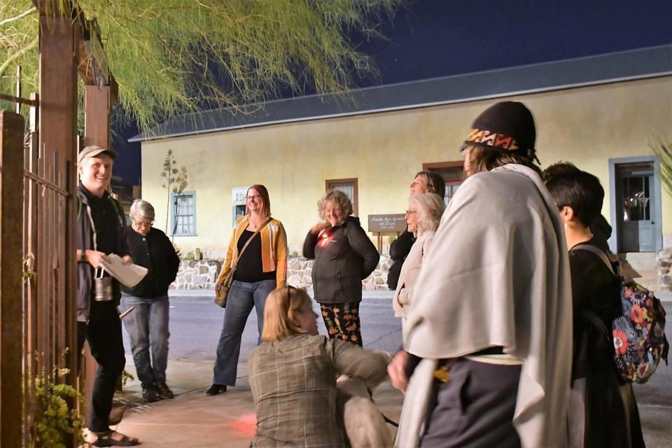
Josh had a passion for life and exploration donning many hats. In 2019 Cohort 3 members and friends enjoyed a meal and tour of Haunted Tucson with Josh as our tour guide. Just recently we were discussing getting together again for a rerun of this fun and intriguing adventure together.


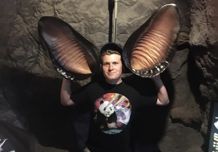
“Bringing the Zoo to You”, that’s Josh with Jed Dodds videoing a segment about bears. Josh especially loved the Andean Bears he cared for as a zookeeper. A chance run in on the day this segment was being filmed resulted in this photo. Josh was my hero, he had my dream job and he was totally invested in being the best he could be.

Tribute and Photos, Kathy McLin (C3)
Only knowing Josh for a short time this year, he touched my life by his knowledge, his dedication to PCMN but especially by his gentleness of spirit. I volunteered with him on the City Nature Challenge and iNaturalist program. His enthusiasm for the Master Naturalist program was evident and so positive. Even though I know how to use iNaturalist, I was going to join the upcoming class to support his dedicated efforts. More recently I trained with him to become a Bat Conservation International Ambassador. He was so patient in explaining to me again and again, how to use the bat acoustic device. The last time I saw Josh was under the Campbell Street Bridge as the bats flew out for the evening. May his spirit eternally soar wild and free as the nature he loved. — Chris Robie (C6)
Josh’s voice came to me several days after his untimely death. I had missed a voicemail message from him, due to the El Paso prefix on his phone number. It was a pleasant, upbeat message about some media publicity he was planning for the BioBlitz. But he was gone. I had to sit down for a while and think about how much we will miss him. Not just this particular project, but all his potential for doing so much good for so many people and for the natural world for years to come. Sincere condolences to friends and family. Such a tragic loss. — Dave DeGroot (C2)
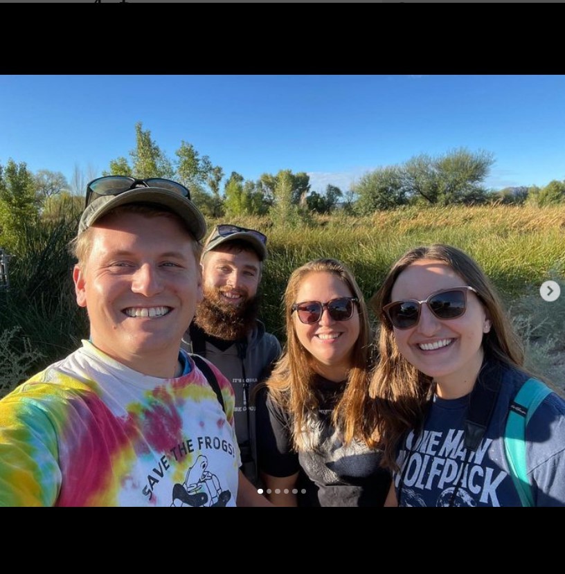
Josh with Sam Wilber (C4)
Josh was an active volunteer for the Coalition for Sonoran Desert Protection and had monitored their wildlife cameras with his buddy, Sam Wilber (C4). These photos are from 2019 while we were still in our PCMN class. Josh had Volunteered for the CSDP “Critter Days” at Catalina State Park with the fourth -graders from the Foothills School District. Josh was passionate about the natural world and generously shared his passion and knowledge with others. — Peggy Ollerhead (C3)


I felt like I knew him though I never met him in person, he was so incredibly present. — Linda Doughty (C6)
Always remember that Josh mattered, that he was important and that he was loved. He brought to this world things that no one else could. — Jane Williamson-Davenport (C1)
I wish I had gotten to know Josh better. Our paths only crossed a few times, but he made such an impression on me. His ready smile & kindness, his obvious dedication & enthusiasm, said so much about who he was. My heartfelt condolences to TJ & his family & friends. — Kim Girard (C6)
Growth of Saguaros at Tohono Chul Park
Written by Paul (Mac) Consigny, Cohort 2
Background.
In 1999, a team of Tohono Chul volunteers, the Saguaro Huggers, began measuring the height of the main stem of specific saguaros within Tohono Chul Park. A total of 251 saguaros were measured for the first time between 1999 and 2001. By 2018, the heights of 186 of these saguaros were still being measured.
Part 1. The effect of height on saguaro growth.
In 2019, the growth rate of each of these 186 saguaros was determined using Excel’s linear regression function and graphics as depicted in the figure below for Saguaro G006. The slope of the blue dashed line is the growth rate (mm/day or mm/year). The mean height was calculated according to the equation:
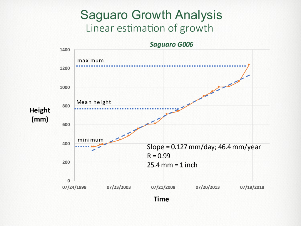
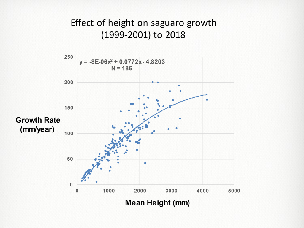
The figure demonstrates that saguaro annual growth rate is directly related to mean saguaro height. The increase in data scatter as mean height increases and a bending of the curve suggests that other variable besides height come into play. Those variables could include: arm development; injuries from freezing, insects, bird holes etc.; variations in weather including precipitation, temperature, evapotranspiration, etc.
Part 2. The effect of weather on the growth rate of fast-growing saguaros.
A second study, based on the first saguaro growth study above, was focused on the effects of weather on saguaro growth. To reduce the variability in the data, we restricted this analysis to the fastest growing saguaros. This restriction was based upon the hypothesis that the fastest growing saguaros would be more sensitive to the effects of weather than the slowest growing saguaros.
Eleven saguaros were chosen for this study. The average height of these saguaros ranged from 1139.5 mm to 2581.0 mm and the growth rates ranged from 111.2 mm/year to 200.6 mm/year.
A. Effect of precipitation on fast-growing saguaros.
For our analyses of weather, we chose to use data for the Tohono Chul location obtained from the Climate Engine database (ClimateEngine.com).
Precipitation at Tohono Chul occurs annually over two seasons, the summer monsoon, and the winter season. We first needed to define the duration of each season (start and end days). For this definition, we first calculated the average daily precipitation for each day of the year for the years 1999 through 2018. This analysis revealed that minimum precipitation for these years occurred June 8/9 and Nov 17/18. Having identified these minimums, we created the following definitions of precipitation:
- Summer precipitation is the cumulative precipitation from June 9 (day 160) through Nov 17 (day 321).
- Winter precipitation is the cumulative precipitation from Nov 18 (day 322) of the previous year through June 8 (day 159) of the current year.
- Calendar year precipitation (CYP) is the cumulative precipitation over the calendar year.
- Precipitation year precipitation (PYP) is the cumulative precipitation from Nov 18 (day 322) of the previous year through Nov 17 (day 321) of the current year.
- Monsoon precipitation is the cumulative precipitation for the months of July, August, and September, the time over which saguaro apical growth is reported to occur. (JR Hastings 1961)
We determined the correlations between annual growth and summer, winter, monsoon, CYP, and PYP for the 11 fast-growing saguaros. The results of these analyses are summarized in the table below.
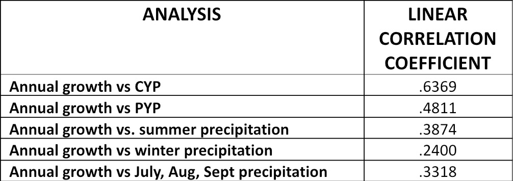
A correlation coefficient greater than 0.205 is considered statistically significant (p<.05; N = 92). Therefore, all correlations in the table are statistically significant. Also, the closer the correlation is to 1.0, the stronger the correlation.
The linear relationship with the highest correlation, annual growth vs CYP, is depicted in the graph below.

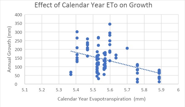
B. Effect of evapotranspiration on annual growth.
Another factor that could influence saguaro growth is evapotranspiration, the process by which water is transferred from the land and other surfaces to the atmosphere by evaporation and by transpiration from plants. We obtained evapotranspiration data for the Tohono Chul location from the Climate Engine (https://ClimateEngine.com). The data was expressed as a reference ETo – the estimated evapotranspiration from a well-watered, full-cover grass surface, 8-15 cm in height. Factors that influence evapotranspiration include surface water (area, depth, temperature), atmospheric temperature and humidity, topography, and vegetation.
We determined the correlation between calendar year ETo and saguaro annual growth for the 11 fast-growing saguaros. The correlation coefficient was 0.4746 (P < 0.001) with a negative slope suggesting that as ETo increases annual growth decreases.
C. Effect of precipitation and evapotranspiration on fast growing growth.
Since both precipitation and evapotranspiration affect plant growth, we combined these two variables into a ratio (calendar year evapotranspiration /calendar year precipitation) where we expected that growth would increase as this ratio decreased. The linear correlation is depicted below.
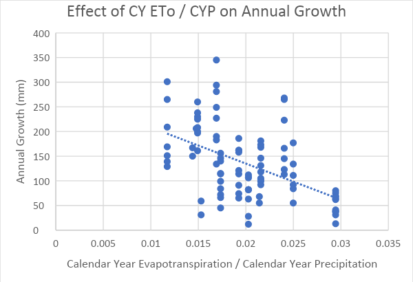
Note that the correlation between annual growth and the CY ETo / CYP ratio (0.4976) was less than the correlation between CYP and annual growth (0.6369) suggesting that the addition of ETo as a variable failed to improve the correlation.
The scatter in the graph above suggested that another variable or variables should be included in the analysis. Since our first study demonstrated that growth rate is directly related to average height, we normalized / adjusted the data to correct for average height differences. The graph below shows the linear relationship between CY ETo / CYP and annual growth after correction for height.
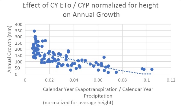
The graph below shows the curvilinear (exponential) relationship between CY ETo / CYP and annual growth.

All three of the above graphs demonstrate that as numerator calendar year ETo increases and / or the denominator calendar year precipitation decreases, annual growth decreases. Correcting for differences in saguaro height reduces data scatter and improves the correlation coefficient (0.4976 to 0.7113). Fitting an exponential relationship to the height-corrected data further improves the correlation coefficient (0.7113 to 0.7633).
D. Summary of Results:
- Annual saguaro growth is directly related to average saguaro height.
- Saguaro growth is directly correlated to precipitation (P<0.001) as measured by CYP, PYP, and winter, summer, and July-August-September / monsoon precipitation. Calendar year precipitation was the most predictive measure of saguaro annual growth (r = .6369).
- Saguaro growth is directly correlated to calendar year evapotranspiration (r = 0.4746).
- Annual saguaro growth is inversely related to CY ETo / CYP (r = 0.4976).
- Correcting for differences in average height reduced data scatter and improved the correlation between CY ETo / CYP and annual saguaro growth (0.4976 to 0.7113)
- Fitting an exponential curve to the data further improved the correlation coefficient between CY ETo / CYP and annual saguaro growth (0.7113 to 0.7633).
E. Conclusion:
The results of this study demonstrate that multiple factors affect the annual growth of saguaros. These factors include average saguaro height, precipitation, evapotranspiration (factors that contribute to evaporation including soil moisture atmospheric temperature and humidity, and topography, and factors that contribute to transpiration including saguaro surface area, density of stomata, opening of stomata, and timing of the opening of the stomata). Other possible factors not analyzed include sources of water other than precipitation, presence/absence of nurse plants, presence and number of arms, and presence/absence/magnitude of disease or injury.
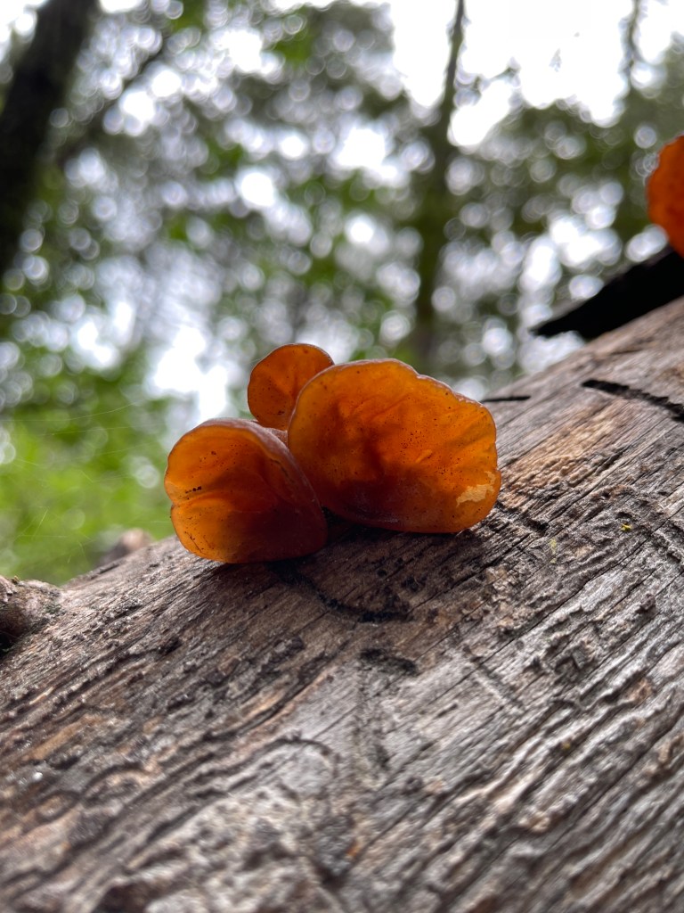
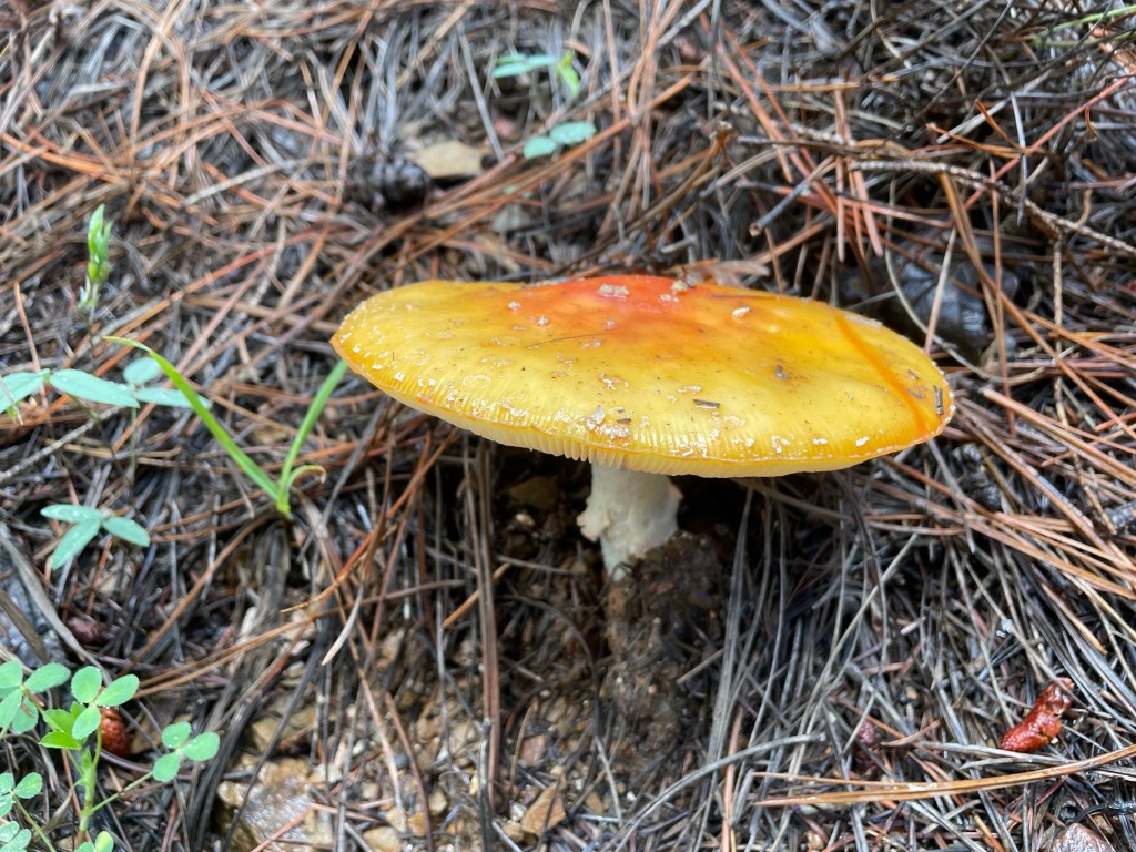
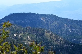
Mycology of Mount Lemmon
Mycology of Mount Lemmon
Blogpost written PCMN Josh Skattum, Cohort 3
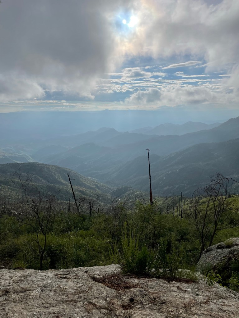
The incredible diversity of Arizona can be observed due to changes in topography as well as a change of seasons. Since this last July I started exploring a diverse “kingdom of life” within one of Tucson’s local Sky Islands. I found myself climbing our mountainous terrains, wading through the overspill summer monsoons, and kept my eyes to both the ground as well as towards upright trees for the glimpse of a fleshy, spoor bearing, living structure. Fungi!


This blogpost is not intended to be used as a resource for identifying edible mushrooms. However, many hobby mycologists enjoy embarking on ventures in search for their own personal consumption. There are many online resources and communities for delving into that content, starting with the Southwest Arizona Mushroom facebook group. Instead, this is intended as a personal narrative as an Arizona Master Naturalist exploring a new topic of interest as well as sharing the educational resources used during this experience.
According to several sources, it’s estimated that there’s over 144,000 identified species of fungi on our planet. Many scientists still aren’t sure on how many more unidentified species there actually are. Here in Arizona, and especially Tucson, we experience a strong change in topography in the form of “Sky Islands”. Tucson’s Sky Islands are surrounded by the Sonoran Desert. This region’s change in topography, resulting in 8 distinct biomes along the Catalina Highway, is also characterized with change of season by summer monsoon rains. The intersection of this diverse topography and weather results in an array of microclimates as observed with the emergence of Southwest Arizona’s fungi.
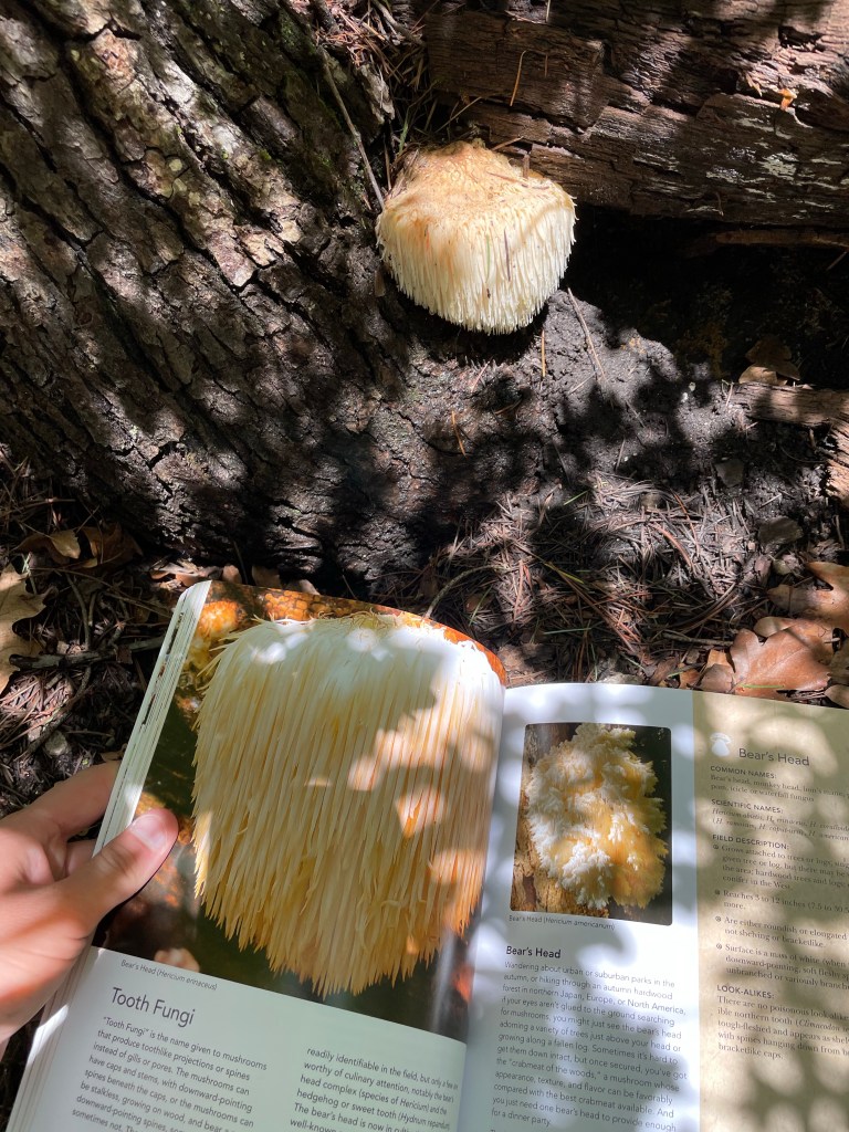
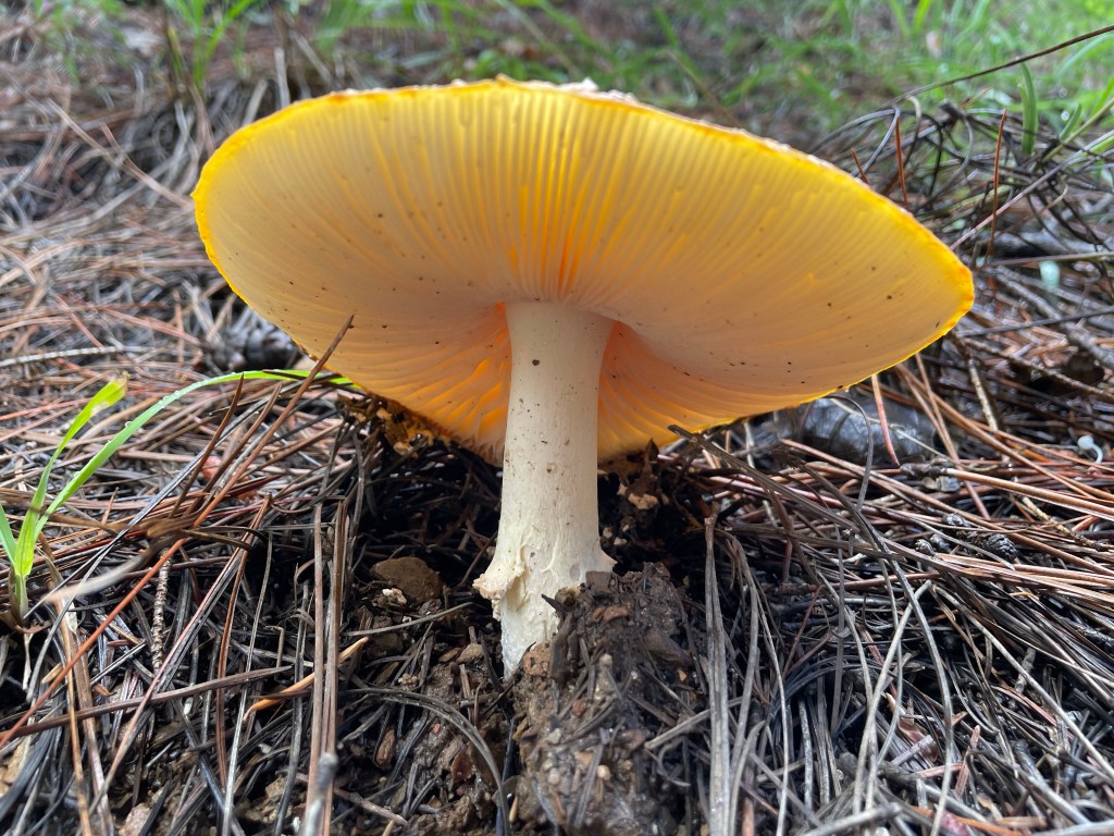
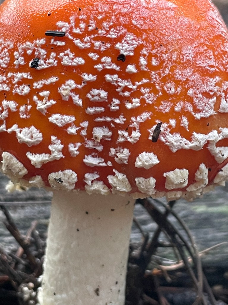
I had very little to no knowledge on mycology and I am still learning each time I set out to look for mushrooms. Several educational resources have been used during my forays including: a gifted book called “The Complete Mushroom Hunter”, inaturalist, and gleaned information from the fb group disclosed above. I learned quickly from inaturalist that for an easier experience making identifications, photographing certain characteristics is needed for a completed identification. For example, for amanitas mushrooms, photos should be taken of both the annulus (if any) as well as the base of the mushroom. There is also an in depth guide found on inaturalist.
My book Mushroom Hunter also shared some naturalist perspectives used for mushroom forraying:
Know your habitat type. Hiking through various habitats, such as mixed hardwood forests, can help broaden the kinds of fungi you will find by exploring diverse spaces. Understanding the kind of “micro” and “macro” ecosystems your mushroom grows on can help narrow in on your searches. Questions that can help with this includes: Does this mushroom typically grow on top of the ground? Below the ground? Along a vertical (possibly living) tree? Does it grow into a decomposing tree? What species of trees can it typically be found on?
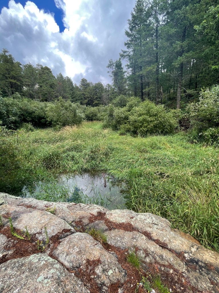
Searching during the perfect season. The portion of the mushroom that we come across is the fruiting body of the organism. Most of the fungus lives below ground and we are selecting to find them during a specific period of their life history. Understanding that timing and what you’re looking for will impact what you find! Typically our ideal timing here in Southwest Arizona coincides with our end of summer monsoons tailing into October.
Sight, Taste, and Smell?! More than just your sense of sight can be used for identifying mushrooms. Some experienced foragers may also use their sense of smell, investigating for a specific or similar aromas, as well as their sense of taste. I did not venture that far with my identification skills as being new to this topic.
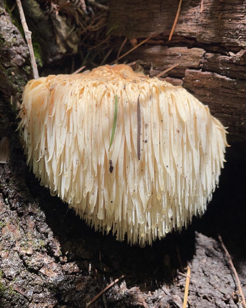
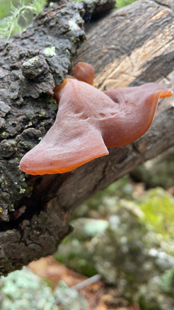
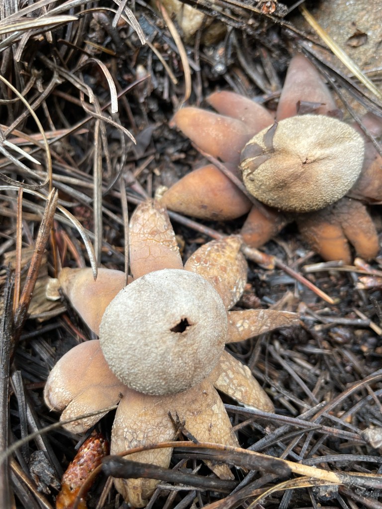
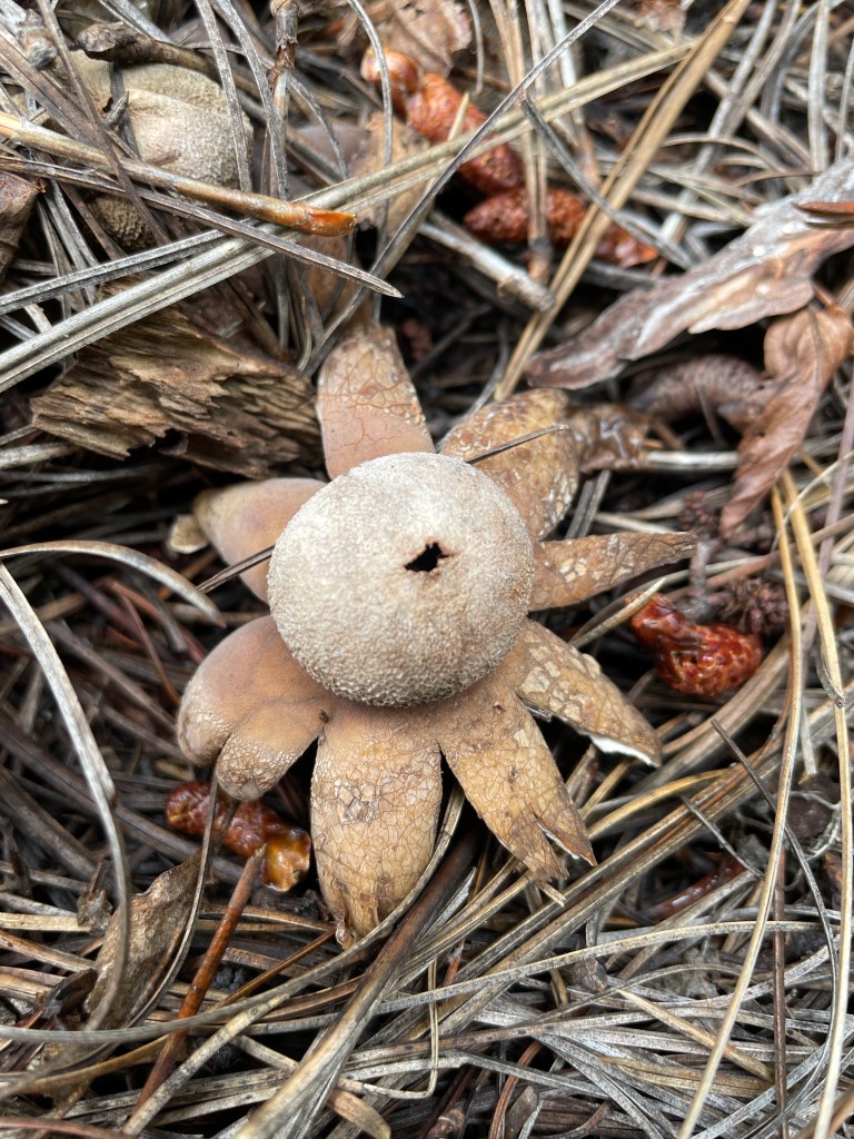
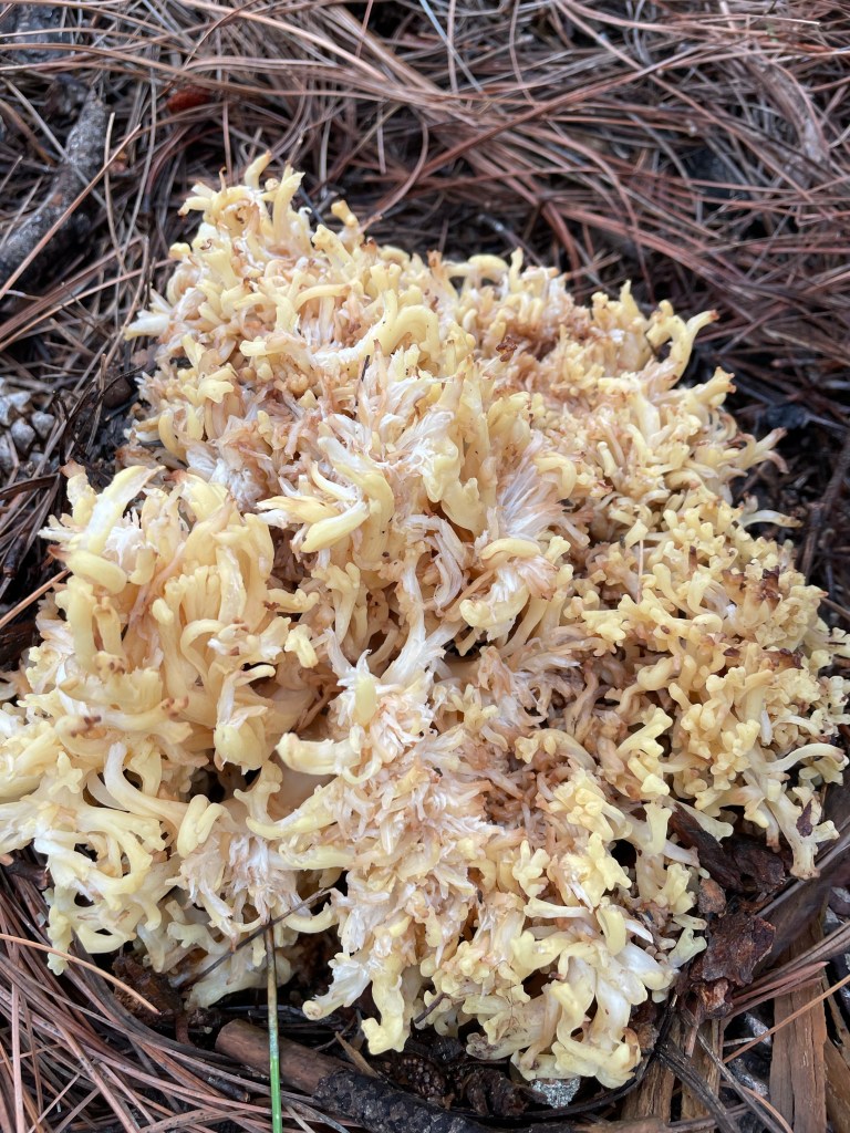
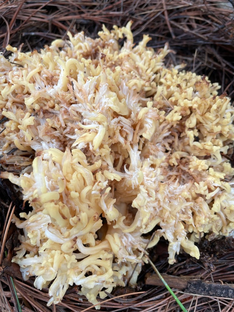
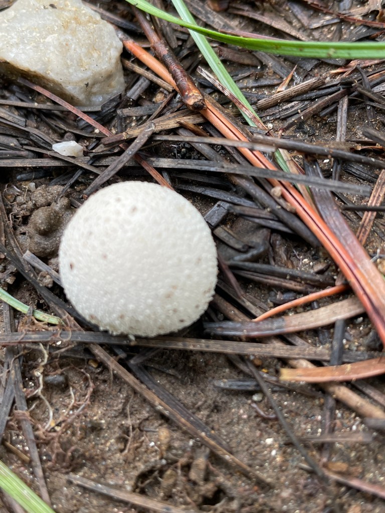
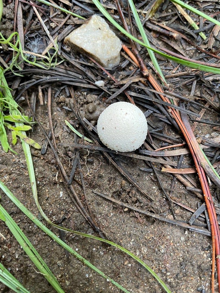
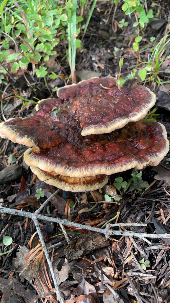
Mushroom Field Groups. Using this guide helped me learn about different “Mushroom Field Groups”. I enjoyed this part of the book the most as it helped me start to develope a pattern of identification while piecing together various natural history as well as physical characteristic’s of fungi. These groups included: Morels and Cup Fungi, Truffles, Chanterelles and Black Trumpets, Tooth Fungi, Coral Fungi, Boletes, Polypores, Jelly Fungi, Mold Fungi, and Giant Puffballs.
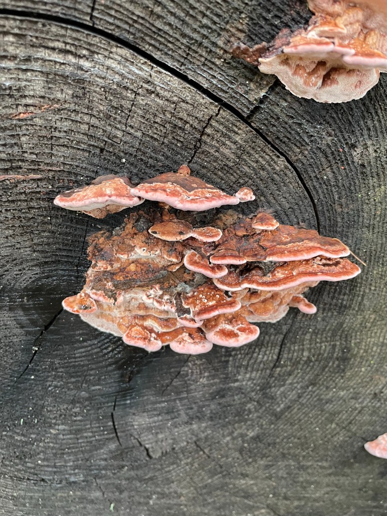
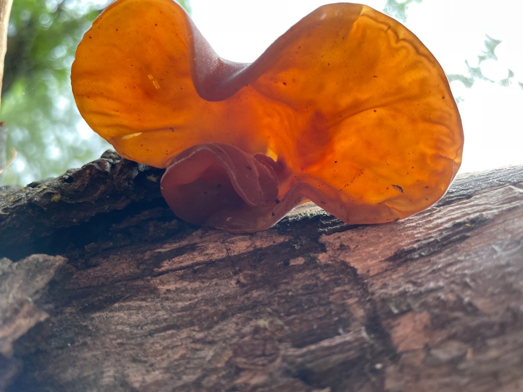
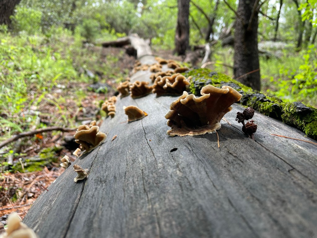
I made over 30 iNaturalist observations documenting various fungi while hiking Mount Lemmon. They range from “research grade identifications” to “pending at various levels”. You can view some of my favorite observations below! Mycology identification is still a learning process for me. While writing this blogpost I even came across a project group called “Mushrooms of the Santa Cantalinas 2022”. I’m excited for next season and to continue to delve into more content while contributing to similar projects. You can also learn more by navigating through my iNaturalist observations, assisting with identifying and documenting these species! By clicking on the URL title above each image below you’ll be taken to that specific iNaturalist observation! All you will need to do is log into your account via the links and you can then also join in on the fun!


“Smoky Polypore”: Was noted that to assist with this identification, may need to know tree species as well as a spore print/ID.


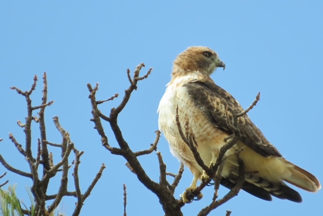
Birding along the Catalina Highway part 2.
Blogpost written by PCMN Kathy McLin
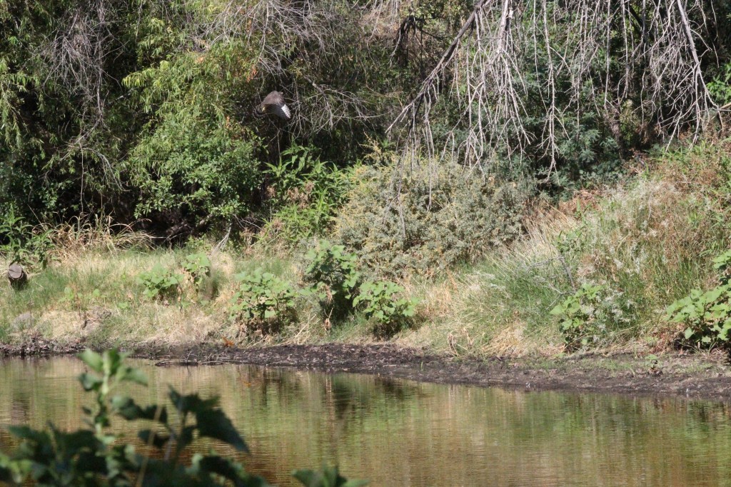
Just before turning onto the Catalina Highway from Mt. Bigelow we pulled the car to a halt to observe and photograph a gorgeous Red-tailed Hawk…….An unexpected surprise.

Our plan was to find a lunch spot and as we traveled down the Highway a picnic and camp ground across from Middle Bear proved to be a treasure of forest life. In this pine/ oak woodland we encountered:
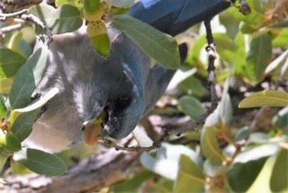
Mexican Jays
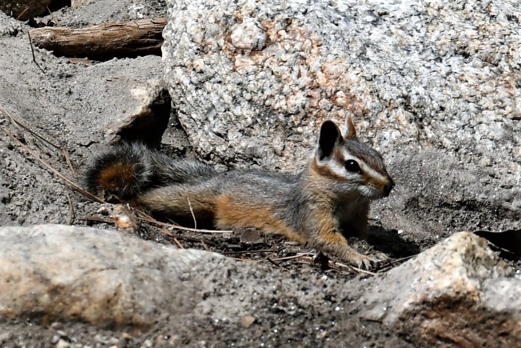
Cliff Chipmunks
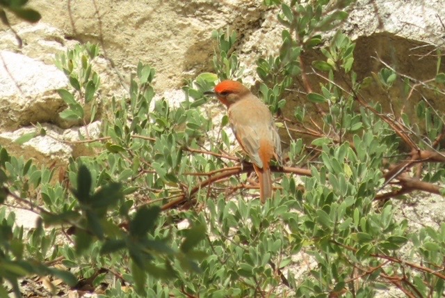
Hepatic Tanagers
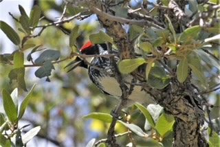
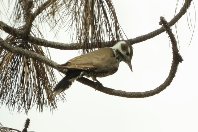
Arizona Woodpeckers
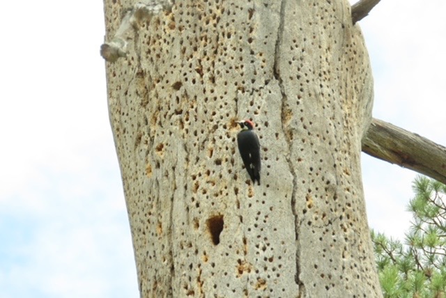
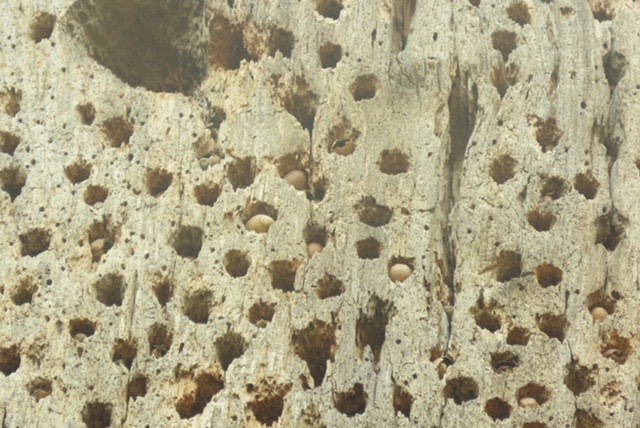
Acorn Woodpeckers
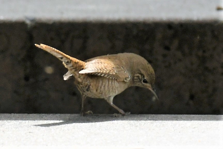
House Wrens
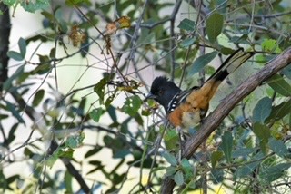
Spotted Towhees
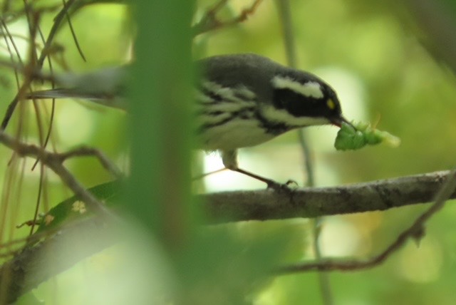
Black-throated Grey Warbler
Robins
Lesser Goldfinches
This area was criss crossed by a sandy wash, oaks and alligator pines, and low shrubs. A cacophony of noise from Mexican Jays and Acorn Woodpeckers greeted us and provided excellent photographic opportunities. A cliff chipmunk took a dust bath in the wash while a Hepatic Tanager hopped from one shrub to another. His yellow feathered mate flew past but stayed hidden.


After lunching a House Wren scurried past and landed on the picnic bench along with a Spotted Towhee. And, in a shrub packed area by where we parked a Black-throated Grey Warbler was dining on bugs.
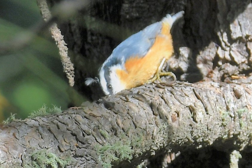
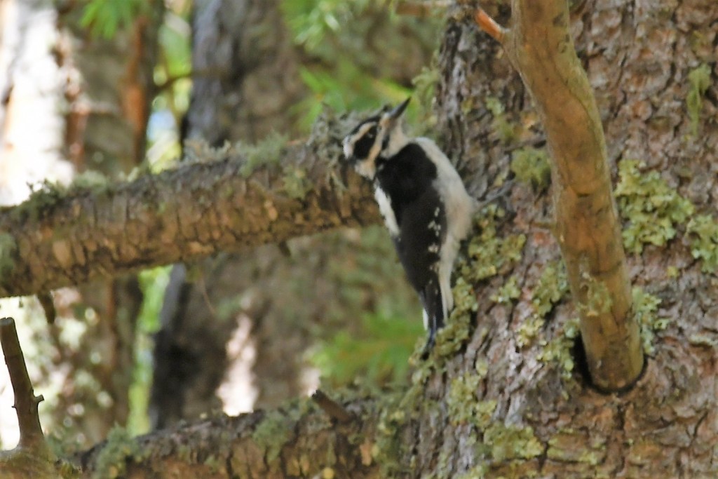
A big surprise was the Female Arizona Woodpecker. A true one of a kind browb-backed, speckled- breasted bird with a white eye patch. She effortlessly climbed the bare pine much like a nuthatch.
Fall is the perfect time to catch sight of birds as they prepare for colder weather. Consider a trip up the Catalina Highway, and maybe I’ll see you there!
Birding along Mt. Bigelow
Written by PCMN Kathy McLin, Cohort 3
Fall is definitely in the air and birds are beginning their migrations to warmer climes. If you have even a passing interest in birds, then a trip along the Catalina Highway is a must.
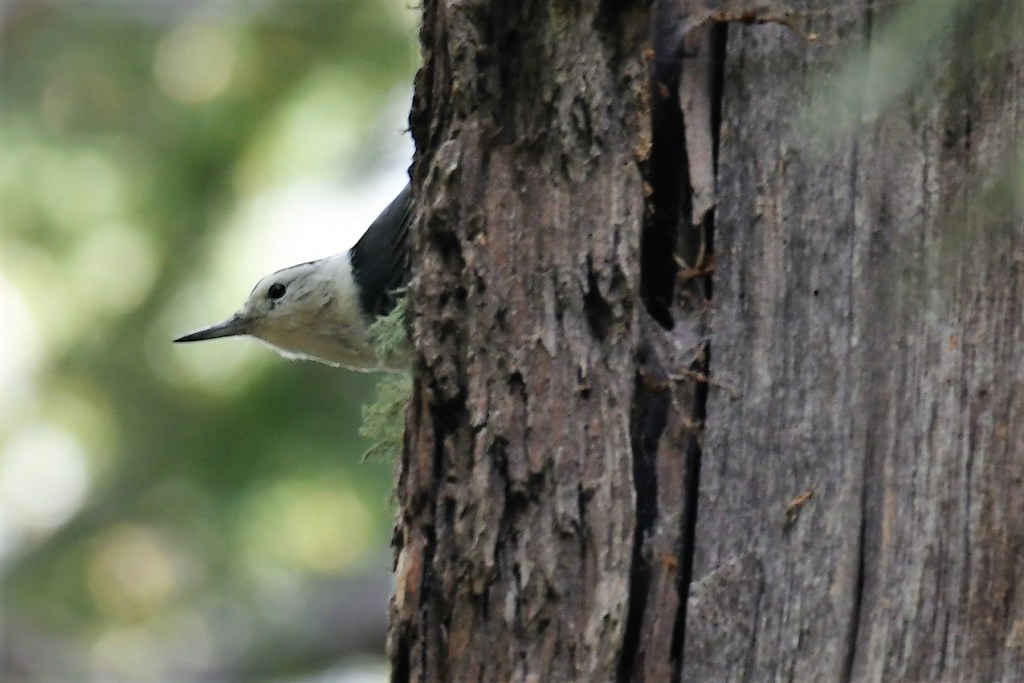
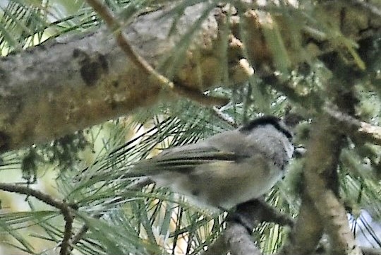
My destination with birder friends took us first up Mt. Bigelow at an elevation of 8,552 ft. Tall pines and carpets of ferns tinted with fall color dressed the landscape. About a quarter mile up we parked and listened for the sounds of birds. Within a few feet we spotted three species of nuthatches, Pygmy, Red-breasted and White-breasted Nuthatches, and the Mountain Chickadee.
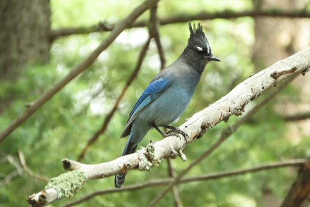
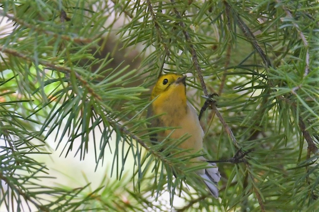
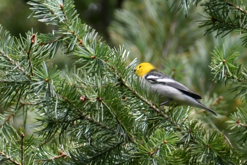
Walking further along the road Stellar Jays were flying about and in a well wooded pull off, a bird I’d never seen before flew into the tree next to me, a female Hermit Warbler. Her mate appeared a short distance away with a yellow head so striking in appearance I was dumbfounded! What Luck!
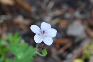
There were Hairy Woodpeckers, Northern Flickers, Yellow-rumped Warblers and a mass of wildflowers, paintbrush, parish goldeneye, hairy seed bahia, and more.
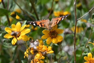
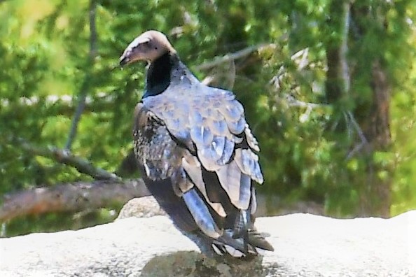
On the summit, painted lady butterflies danced atop the parish goldeneyes. And, sitting on a huge rock was a juvenile Turkey Vulture, feathers resplendent in the morning light.
Part 2 to follow as I share our exploration of a lower elevation and it’s delights.
Two More Species of “Arizona’s Largest Moths” Found in the Tortolita Preserve by Master Naturalists
Written by Dave DeGroot, Sept. 20, 2022
More than 40 species of big “hawk moths” or “sphinx moths” live in the mountains and deserts of Southern Arizona. Until the Master Naturalists’ “Bug Night” on Sept. 15, only two of these big moths had been documented in the Tortolita Preserve. During Bug Night, a third and then a fourth species were positively identified. In addition, the smaller cousin of a really big moth species made an appearance.
The previously seen hawk moths were White-lined sphinx (Hyles lineata) and Rustic sphix (Manduca rustica). On Sept. 15, Master Naturalists observed the Carolina sphinx (Manduca sexta) and the Carolina’s close relative, the Five-spotted hawkmoth (Manduca quinquemaculata). In addition to these, it is likely that there are many more species of big moths in the Preserve’s 2,400 acres. Efforts to document the nighttime insects and arachnids in the Preserve are just getting started.
Another interesting and previously undocumented moth among the hundreds that showed up on Sept. 15 was the beautiful Hubbard’s silk moth (Syssphinx hubbardi), a small cousin of Asia’s massive Atlas moth with its 12-inch wingspan.

The Sept. 15th event featured Dr. Marguarethe Brummerman, a professional entomologist, photographer, and artist who brought her blacklighting equipment to the main gate of the Preserve and helped identify many of the hundreds of insects and arachnids that were attracted to the bright lights. Sixteen Master Naturalists attended and earned Advanced Training hours.
“This is only the second time anyone has tried black lighting in the Tortolita Preserve,” notes organizer Dave Degroot. “All these initial observations make me wonder what other big or amazing night flyers are out there, just waiting to be discovered!”
On Saturday, November 19th, Master Naturalists will play a key role in a big Bioblitz within the Tortolita Preserve. Watch for volunteer sign up information from Franklin Lane, Dave DeGroot, Penny Miller, or Josh Skattum
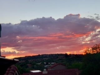
Fall Membership Meeting 2022 & BioBlitz Update
By Franklin Lane
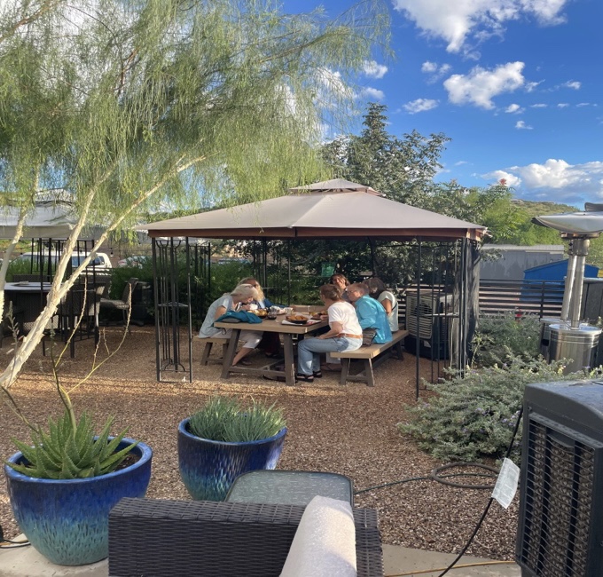
The Pima County Master Naturalist (PCMN) quarterly membership meeting was held on Tuesday, September 13th. Thank you Josh Skattum (C3) for recommending Three Canyon Beer and Wine Garden on Sabino Canyon Rd. It’s a beautiful outdoor venue. Although there were some early light showers to ‘appreciate’, it turned into a lovely evening with a typically stunning Tucson sunset.
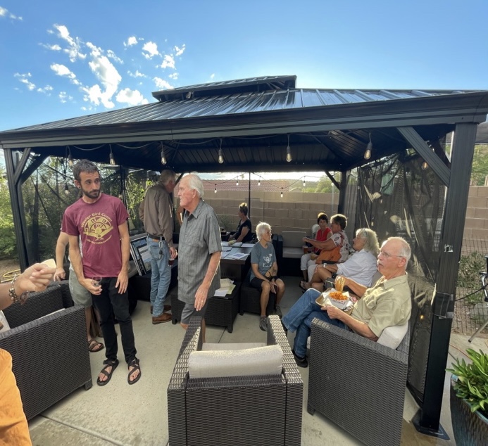
Approximately twenty-five members, and some guests, from all cohorts attended the gathering. Special appreciation to those members who traveled from the far west side! Unfortunately, a lot of Chapter business has been conducted electronically of late, so it was nice to be able to connect some new faces with names. The public venue offered good food and beverages, so we didn’t have to impose on anyone to host. And no cleanup!
The business portion of the meeting started with a welcoming from Chapter President Melissa Fratello (C5). Melissa has assumed the role of President a few months early to give Jan Schwartz (C4) a well-deserved break. Thanks Jan for your leadership on the Board of Directors and for your incredible work with cohorts 5 & 6. Deb Petrich (C1) will also be re-assuming oversight of the Chapter’s Volgistics account until a new administrator can be identified. Thank you Dre Hoerr (C3) for your service to our members the last two years. As always, please get your hours in!
ALSO NOTE; the majority of the current Board of Directors is reaching its term limits (December) and the Chapter really needs other members to consider helping with administration. Admin service for the Chapter is easy, rewarding, and ensures that the organization stays relevant. “If not me, who? If not now, when?” Please contact Melissa or any Board Member with your interest.
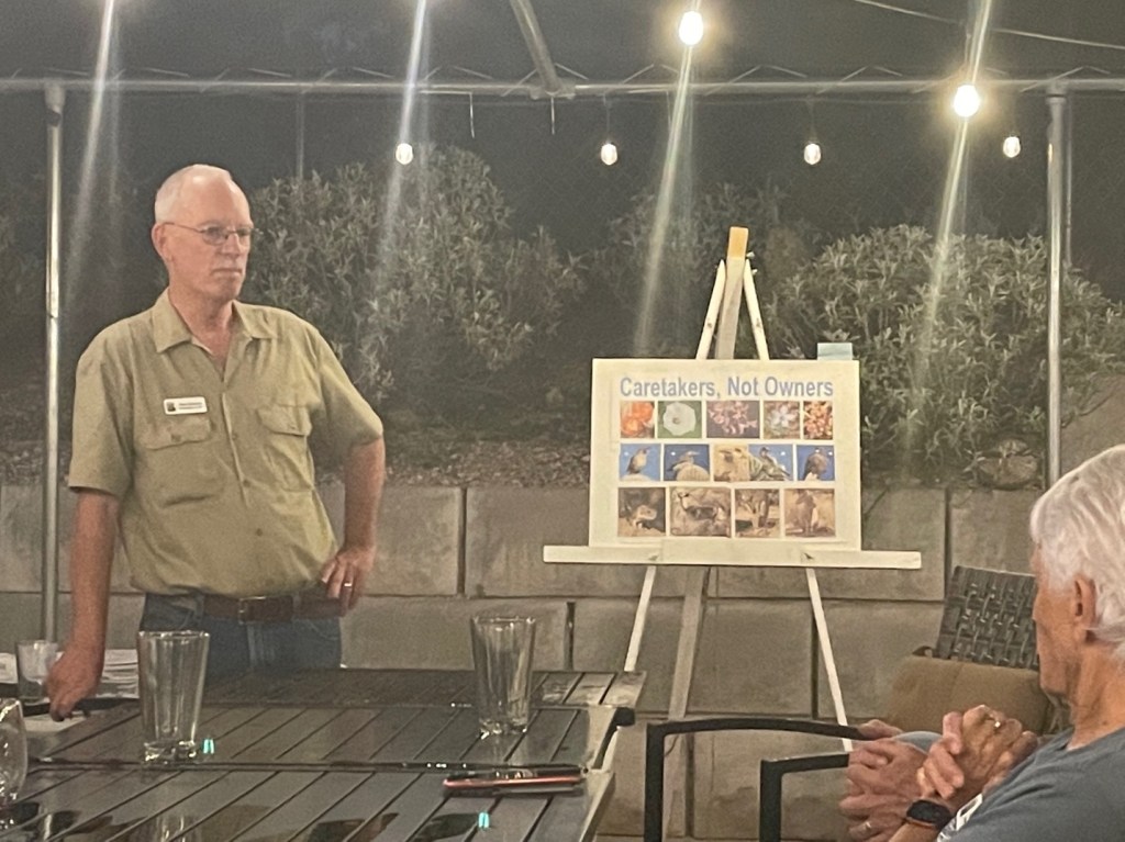
The remainder of the evening was dedicated to a discussion of the Tortolita Preserve BioBlitz scheduled for a Saturday, November 19th. Dave DeGroot (C2) explained the history of the Preserve, the importance of the joint effort, and PCMN’s partnership with the City of Marana to conduct this first ever biodiversity inventory of the area.

Dave also recently attended a planning meeting at the Preserve Trailhead on Moore Rd. (picture below). The City of Marana was represented by Jay Grodman (Natural Resources Supervisor) and Kim Warner. Other partners include Scott Sprague, Arizona Game and Fish as well as Carolyn Campbell and Jessica Moreno from the Coalition for Sonoran Desert Protection. Mark Johnson representing the Tortolita Alliance will handle the advocacy side of the things, allowing PCMN to do what we do best, simply identify the flora and fauna.

INaturalist will be the application used for the BioBlitz. The Preserve has been designated a “Project” within the App. INaturalist is fun and SO EASY, see cheat sheet below. Here is also an online resource on how to use this application. It’s as easy as just downloading the program and you can start practicing in your backyard!

One should also be aware that there is a ‘No Photo’ option within INaturalist. This is helpful for those fast-moving birds and butterflies that can’t be snapped. However, we will need to try to identify them the old-fashioned way! So, bring your field guides. Unfortunately, without photo verification the sighting only receives a ‘casual’ grade.
Marana hopes to have the BioBlitz ‘signup form’ online in early October. We will get that out to the Chapter as soon as it is available. In the meantime, Jay Grodman encourages everyone to register as a volunteer here: https://www.maranaaz.gov/volunteer
It’s a simple process. Just put BioBlitz in the Comments section.
While details are still being sorted, it is anticipated that small groups of participants (armed with INaturalist) will be led through various parts of the Preserve by designated ‘Guides’ familiar with the approximate 9-mile Loop and the area diversity. Several Master Naturalists have already volunteered for these leadership roles.
Kathy Balman (Maricopa Chapter)
Jenna Marvin (C3)
Olivia Carey (C3)
Paul Stillman (C3)
Vicky Ettleman (C3)
Marcia Lambert (C5)
Dave DeGroot (C2)
Wow Cohort 3 way to go!! If you are familiar with the Preserve and would like to participate as a guide, please let Franklin Lane or Dave DeGroot know. For those members who’d like to be involved but would rather not tromp around the desert, Kathy Sudano (C3) will be looking for folks to staff a Table at the event. Good opportunity to identify those new interns for C7 and/or C8.
The next opportunity for the Chapter to assemble as a community will be for the Annual Membership Meeting in early December. It will include selection of new Executive Officers:
President-Elect (2024 term), Treasurer and Secretary (2023-24).
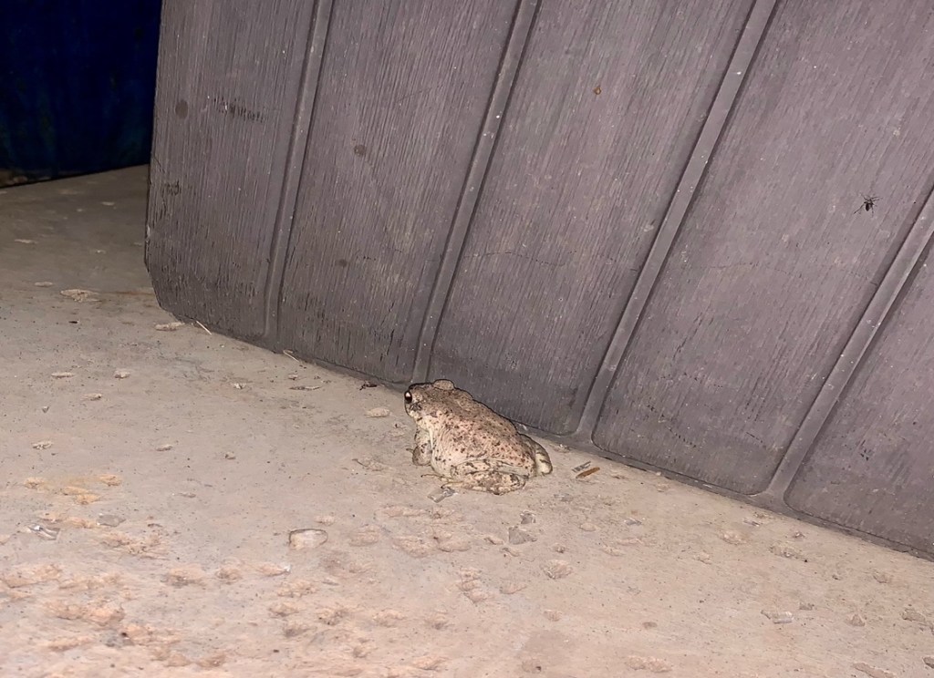
Finally, this red spotted toad joined us at the bar and was welcomed by Jan Schwartz (C4), Carrie Barcom (C3) and Angela Seidler (C6). Ever the Naturalists!
Pima County Master Naturalists Support the 2022 Southeast Arizona Birding Festival
By: Franklin Lane
The annual SE Arizona Birding Festival, sponsored by the Tucson Audubon Society (a PCMN Partner Organization), was held from August 10-14 this year. The Pima County Chapter has traditionally staffed an education and recruitment table in the main ballroom of the Doubletree Hotel along with vendors and other natural science, outreach organizations. This year’s event organizer Kathe Sudano (C3) increased Chapter participation by arranging two field excursions led by Master Naturalists. On Thursday, Chapter President- Elect Melissa Fratello (C5) and Franklin Lane (C1) led a group of Festival attendees on a Desert Discovery Hike in Sabino Canyon. On Friday, Karen Vandergrift (C3) and Franklin led a Sky Island Discovery Drive/Hike up Mt Lemmon. Details and pictures are below. According to Kathe, the Chapter’s increased footprint this year really helped to “put us on the map.”
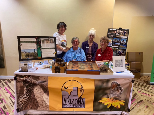
Volunteers over the long weekend also included Chapter President Jan Schwartz (C4), Dana Hook (C6), Peggy Ollerhead (C3), Kathy Mclin (C3), Carol Anderson (C1), Marcia Lambert (C5), Penny Miller (C2) and Jane Davenport (C1). These Chapter Members spoke directly with (169) Festival attendees and responded to (14) serious requests for information about the Chapter’s next class in 2023 (C7). This year’s tabling effort was particularly challenging because the Chapter was simultaneously supporting ‘Critter Night’ at The Mission Gardens. This overlap required additional exhibitry and volunteers. These outreach opportunities are fun and an easy way to acquire service hours. They also allow members from different cohorts to get to know one another. Everyone should consider responding to the next ‘call for volunteers’ from the Outreach Committee. The Committee itself can also use additional help. Note, you do not have to be a Board Member to participate on any Chapter committee. Contact Kathe Sudano or Peggy Ollerhead if interested. The Communications Committee (Josh Skattum C3) and Advanced Training (Penny Miller) are also looking for volunteers. Contact directly or through the Board of Directors: board-pimamn@azmasternaturalist.org

Melissa and Franklin met (5) Festival participants at the Bear Canyon Trailhead at 0600 on Thursday 8/11. A total of eight, the maximum, had signed up but the monsoon weather may have scared a few off. The morning was indeed threatening but paid off with great cloud cover throughout the excursion. Hikers were from as far away as Cincinnati, Ohio. In addition to being introduced to the overall ecology of the Sonoran Desert, Melissa was able to identify (24) different taxa for the birders.
Sabino Species list
9 White-winged Doves, 3 Purple Martins, 4 Mourning Doves, 1 Black-tailed Gnatcatcher, 3 Greater Roadrunners, 1 Rock Wren, 4 Anna’s Hummingbirds, 5 Cactus Wrens, 1 Broad-billed Hummingbird 2 Curve-billed Thrashers, 1 Turkey Vulture, 1 House Finch, 1 Red-tailed Hawk, 1 Lesser Goldfinch, 2 Gila Woodpeckers, 3 Rufous-winged Sparrows, 4 Ladder-backed Woodpeckers, 7 Black-throated Sparrows
1 Pacific-slope Flycatcher, 1 Abert’s Towhee, 1 Bell’s Vireo, 2 Yellow Warblers, 13 Verdins, 2 Pyrrhuloxias
The 2.7-mile hike included an introduction on the Bajada Loop Nature Trail then out the Esperero Trail. Dropping down the Bluff Trail to Sabino Creek, the hikers were truly amazed by the transition from Desert Scrub to the Riparian Biome. With the erosive effect of the recent strong rains, Sabino Creek flowed like chocolate milk.
On Friday 8/12 participants were met at the Doubletree at 5:30 am for the Sky Island trip. The Festival organizers provided a van and snacks. There were (7) birders on this trip from Seattle, San Francisco, Florida, and a couple of locals. They first received an overview of area geology and Sky Island biomes at Babad Doag. Next stop was Windy Point and then a great visual appreciation of the ‘Basin and Range Geological Province’ at San Pedro Overlook. Catalinas, Galiuros, Pinalenos… Interestingly, the most rewarding birding opportunity was near the parking lot next to the Lemmon Trailhead. Unfortunately, just short of halfway through the planned hike (Lemmon Loop) some scary weather closed in, and the group was moved at ‘faster than birder speed’ back to the van. Heavy rain and hail blasted the drive down from Summer Haven to about Rose Canyon Lake. To compensate for the lost opportunity Karen suggested a stop at Molino Basin. The following is a list of what she was able to help identify for the participants.
Stop 1, Babad Do’ag. Species List
3 Mourning Doves, 1 humming bird species, 2 Gila Monsters, 1 Verdin, 2 Cactus Wrens, 3 Black Footed Sparrows, 1 Rufous-Crowned Sparrow, 2 Spotted Towhees.
Stop 2, Windy Point. Species List
1 Cassin’s/Western Kingbird, 1 Mexican Jay, 1 Spotted Towhee.
Stop 3, Mount Lemmon Trail Species List
1 white-throated swift, 2 broad-tailed humming-birds, 1 red-tailed hawk, 1 hairy woodpecker, 1 northern flicker (red shafted), 2 cordilean fly catchers, 1 warbling verio, 1 stellar jay, 2 common ravens, 6 mountain chickadees, 2 red-breasted nuthatches, 3 white breasted nuthatches, 10 pygmy nuthatches, 2 american robins, 2 lesser goldfinches, 11 yellow-eyed junco, 2 spotted towhees, 1 grace’s warbler, 1 black-throated gray warbler, 2 townsend’s warblers, 4 hermit warbler, 3 red-faced warblers
Stop 4, Molina Basin Species List
1 Anna’s hummingbird, 1 Woodhouse’s scrub jay
2 House finches, 2 Canyon towheees, 2 Abert’s towhees, 1 Hooded Oriole
Both Melissa and Karen have been able to share these lists with the Birders.
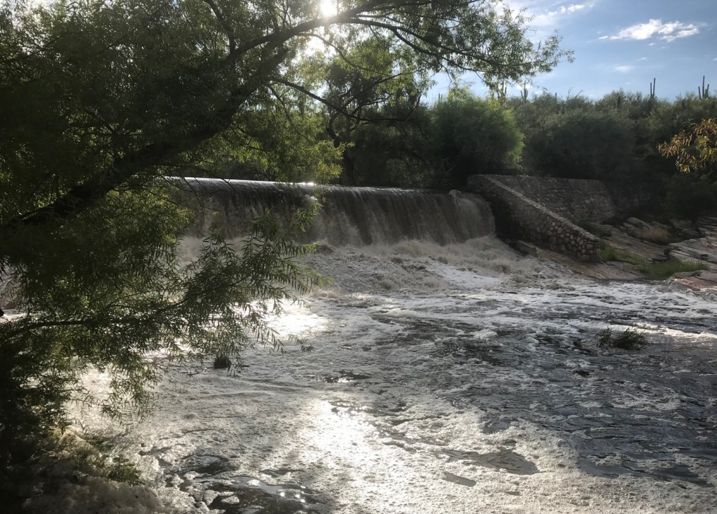
Comes the Monsoon
Blogpost written by PCMN Kathy McLin and Joshua Skattum, Cohort 3
Comes the Monsoon
“Comes the monsoon
Whose arrival is announced by nature’s percussion, with deep drum rolls and cymbal clashes, grey sky and lightening shows.
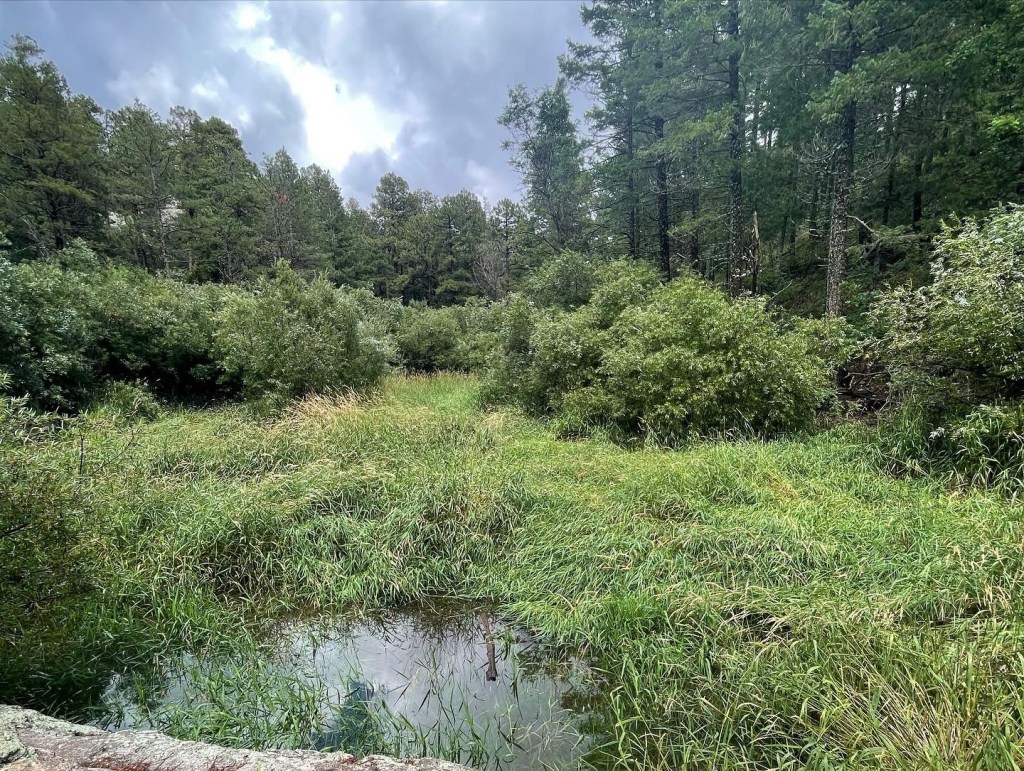
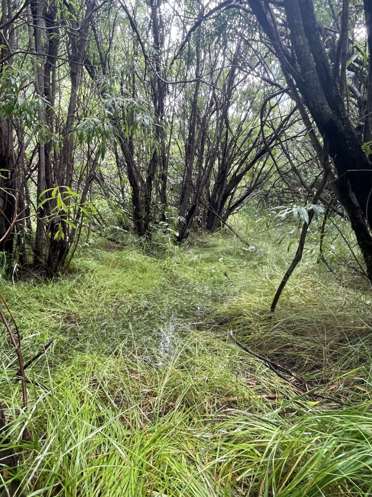
A welcomed performance, one of pure life. Anointing the land, hastening the flow of rivers and streams. Filling ponds and pools and seeping in to the earth from which seeds and roots issue flowers and trees, all the green things that nourish body and soul.
PURE LIFE…..where creation begins and fulfills its part in the circle of life. Drink in that which is given to sustain and reawaken, to nurture and grow, to heal and caress this land, our home.
Comes the Monsoon, comes New Life.”
Kathy Carterr McLin
7/22/2019
Receiving only 3 to 15 inches of rain per year, the Sonoran Desert is amongst some of our most dry and arid landscapes on our planet. When visualizing this region, many picture it as a desolate space. And yet every summer Arizonans look to the sky and recognize a transition of seasons and a burst of precipitation. We become mesmerized and inspired and enjoy a new season setting in, monsoon season.

The word Monsoon comes from the Arabic word mausim, meaning “seasonal”. It describes the system of winds that change throughout the year, bringing in wet and dry periods. This process is fueled by the Sea of Cortez, creating a biseasonal precipatory system delivering dynamic bursts of summer rainfall and slow long winter rain. As plants and animals have adapted to the dry and hot months of May and June, they relish for the anticipated rain. A burst of life is observed.


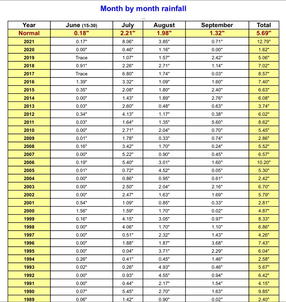
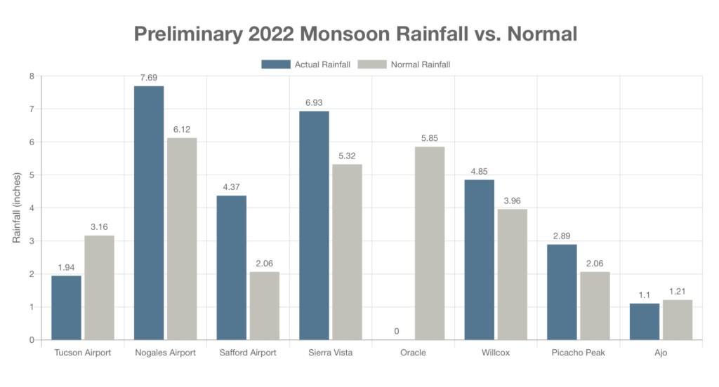
The Arizona Upland subdivision of the Sonoran Desert is our wettest desert region. A stark comparison to Yuma, one of the driest places on Earth, averaging only 3 inches of rain each year. The past three years we’ve experienced how rainfall in the desert is unpredictable. Plants and animals here have adapted to wait, reserving energy for when resources are most available to procreate. In 2020 we experienced a drought, receiving only 1.62” of rain for the entire summer monsoon season. This was followed by one of the wettest Julys on record, bringing in over 12 inches of rain for the 2021 July season. According to the National Weather Service, June 2022 has been the 5th warmest and 38th wettest monsoon season. You can also track our current 2022 monsoon reports via the NOA website!
Resources/References
https://www.wrh.noaa.gov/twc/monsoon/monsoon.php
https://www.wrh.noaa.gov/twc/monsoon/rainfall.php
Phillips, Steven J., et al. A Natural History of the Sonoran Desert. Arizona-Sonora Desert Museum Press, 2015.

You must be logged in to post a comment.